

Winter Event Routes
Project Navigation:
WINTER MOOSE DAY 2026 - February 7 & 8, 2026
Winter Routes
Most routes are not on trails. Many follow Forest Service roads or creek beds for the entire route. GPS navigation is recommended!
Training - January 31
A mandatory in-person training for first-time participants will be held on Saturday, January 31, from 10:00 am to noon in the Berry Center Auditorium.
If you are unable to attend the in-person training, please watch the virtual training below.
BROWSE ROUTES BY REGION
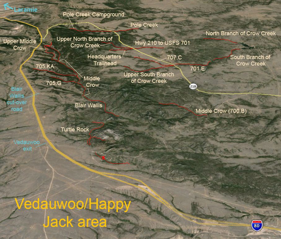
Note: Adopted routes are crossed out.
701.E: 4 mi total: difficulty: moderate
705.G: 2 mi total: difficulty: moderate (this route is after a gate closure, which adds an additional 2.2 miles one way to the start of the routes)
705.KA: 3 mi total: difficulty: moderate (this route is after a gate closure, which adds an additional 2.2 miles one way to the start of the routes)
707.C: 3 mi total: difficulty: moderate
Blair Wallis: 4 mi total: difficulty: hard (4x4 may be needed to access) - Adopted
Headquarters Trailhead: 2 mi total: difficulty: moderate
Hwy 210 to USFS 701: 2 mi total: difficulty: moderate
Middle Crow (700.B): 3 mi total: difficulty: moderate
Middle Crow: 5 mi total: difficulty: moderate
North Branch of Crow Creek: 3 mi total: difficulty: moderate (Route starts on State Park property so state park fee payment is required.)
Pole Creek (732): 4 mi total: difficulty: moderate
Pole Creek Campground: 4 mi total: difficulty: easy
South Branch of Crow Creek: 2.5-3 mi total: difficulty: moderate (Route starts on State Park property so state park fee payment is required.)
Turtle Rock: 4 mi total: difficulty: moderate
Upper South Branch of Crow Creek (707.D): 3 mi total: difficulty: moderate
Upper Middle Crow: 4 mile loop; difficulty: moderate
Upper North Branch of Crow Creek (707.D): 3 mi total: difficulty: moderate
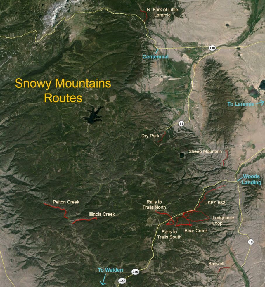
Note: Adopted routes are crossed out.
Bear Creek: 4.5 mile loop; hard
Dry Park: 3 miles total - there and back; moderate
Illinois Creek: 5 miles total - there and back; moderate
Lodgepole Loop: 5.5 mile loop; hard
North Fork of Little Laramie: 4 miles total - there and back; moderate
Pelton Creek: 6 miles total - there and back; moderate
Rails to Trails North: 3.25 miles total - there and back; moderate
Rails to Trails South: 5 miles total- there and back; moderate
Sheep Mountain: near Woods Landing; 3 miles total - there and back; hard
USFS 533: 6 miles total - there and back; moderate
Woods Creek Loop: 3 mile loop; easy
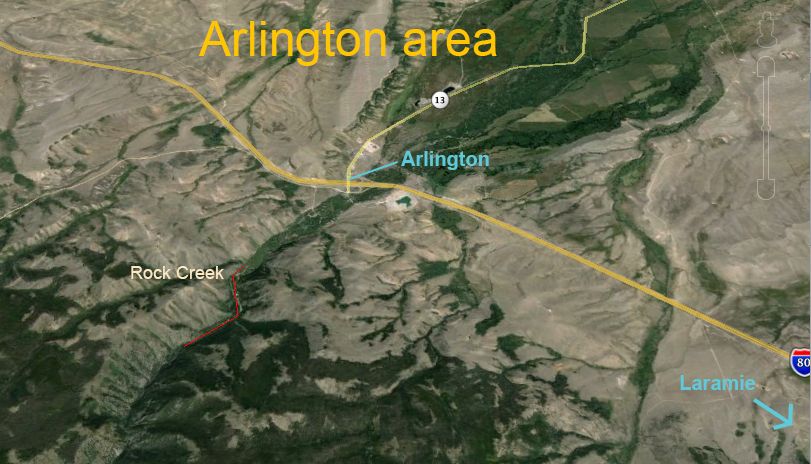
Note: Adopted routes are crossed out.
Rock Creek: near Arlington (see map); 3 mi total - Difficulty, moderate